Description
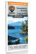
This BRMB Adventure topographic map for the Desolation Sound Area of BC highlights all the islands, channels and inlets, campsites, paddling routes, parks, trails and recreation features in the area. Covering 960 sq. km (370 sq. mi) in total, this map can be used for camping, canoeing, kayaking, exploring, fishing and wildlife viewing, and charts the areas of Desolation Sound Marine Park, Bliss Landing, Copeland Islands Marine Park, Cortes Island, Curme Islands, East Redonda Island, Lund, Malaspina Peninsula, Okeover Inlet, Roscoe Bay, Sarah Point, Savary Island, Sunshine Coast Trail, Tenedos Bay, Unwin Lake, West Redonda Island and more!
The printed version of the map is displayed at 1:50,000 scale on 61 x 94 cm (24 x 37 in) paper. You can choose between having the map printed on regular water-resistant paper or a more durable waterproof synthetic. The Wall Maps have been customized to display nicely and fit into common picture frame sizes so you can hang on the cabin, home or workshop wall. They are available in three different sizes and come printed on the waterproof synthetic material.
Map Features: Highways, Logging Roads, Land & Water Features, Parks, Adventure Points of Interest, Campgrounds, Hiking Trails, Motorized Trails, Paddling Routes, Hunting & Fishing Areas, Winter Recreation and More.
Areas Covered: Desolation Sound, Bliss Landing, Copeland Islands Marine Park, Cortes Island, Curme Islands, East Redonda Island, Lund, Malaspina Peninsula, Okeover Inlet, Roscoe Bay, Sarah Point, Savary Island, Sunshine Coast Trail, Tenedos Bay, Unwin Lake, West Redonda
Print Features:
- Printed on regular water-resistant paper or durable waterproof and tear-resistant material
- Includes industry leading cartographic detail and state-of-the-art relief shading
- Countless points of interest, hiking trails, campsites, boat launches, paddling routes and more!
- Easy to read, large-scale 61 x 94 cm (24 x 37in) map at 1:50,000 scale
- Seamless map coverage requires no page turning