South Clayoquot Sound "Deck Topper" Kayaking/Marine Mapsheet #208 Description
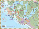
This mapsheet packages the inner waters of Clayoquot Sound including Tofino Inlet and routes to circumnavigate Meares Island, as well as routes to the beaches of Vargas Island and the islands and islets north to Whitesand Cove on Flores Island. Those venturing to Cow Bay and points north along Flores Island including Hot Springs Cove will want to have mapsheet #207 North Clayoquot Sound as well.
Clayoquot Sound Series: Three mapsheets detail Clayoquot Sound from the south tip of Nootka Sound through Hesquiat Peninsula, past Flores and Vargas islands to Tofino. Each map is designed to complement one another with enough overlap to be useful on the water yet each providing oversight of a distinct section of the Clayoquot coast. (South Clayoquot Sound is mapsheet #208).
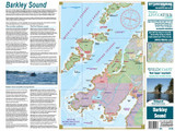
The layout is a regional overview on the full page of one side, and on the other side a detailed closer-perspective view of the complex waterways around Tofino to Vargas Island. Also included are planning details such as expected water conditions, what to see and do, the First Nations context, launching information and background on Vargas Island Provincial Park.
The mapsheet is created by Wild Coast Publishing using some of the latest technology available to provide a high-quality printed image on waterproof/durable synthetic polymer stock. The stock is picked as the best for the purpose, and is significantly thicker than most papers at 10 mil weight.


